 MISSION
Ths mission of the Florida Sinkhole Research Institute (FSRI) is to be the Center of Excellence for the knowledge of sinkholes. The institute wil provide education, service, and technology transfer on sinkhole acitivities to individuals and agenices from local, state, nation, and world-wide through research, literature search, and communication.
Sinkholes are karst features, formed by the dissolving of the underlying rock, usually limestone. Long-term dissolution creates a network of cavities in the rock, but surface collapse usually occurs when unconsolidated over-burden sediment suddenly erodes downward into these voids: the cover collapse or cover subsidence mechanism. Repeated collapse at the same site is possible.
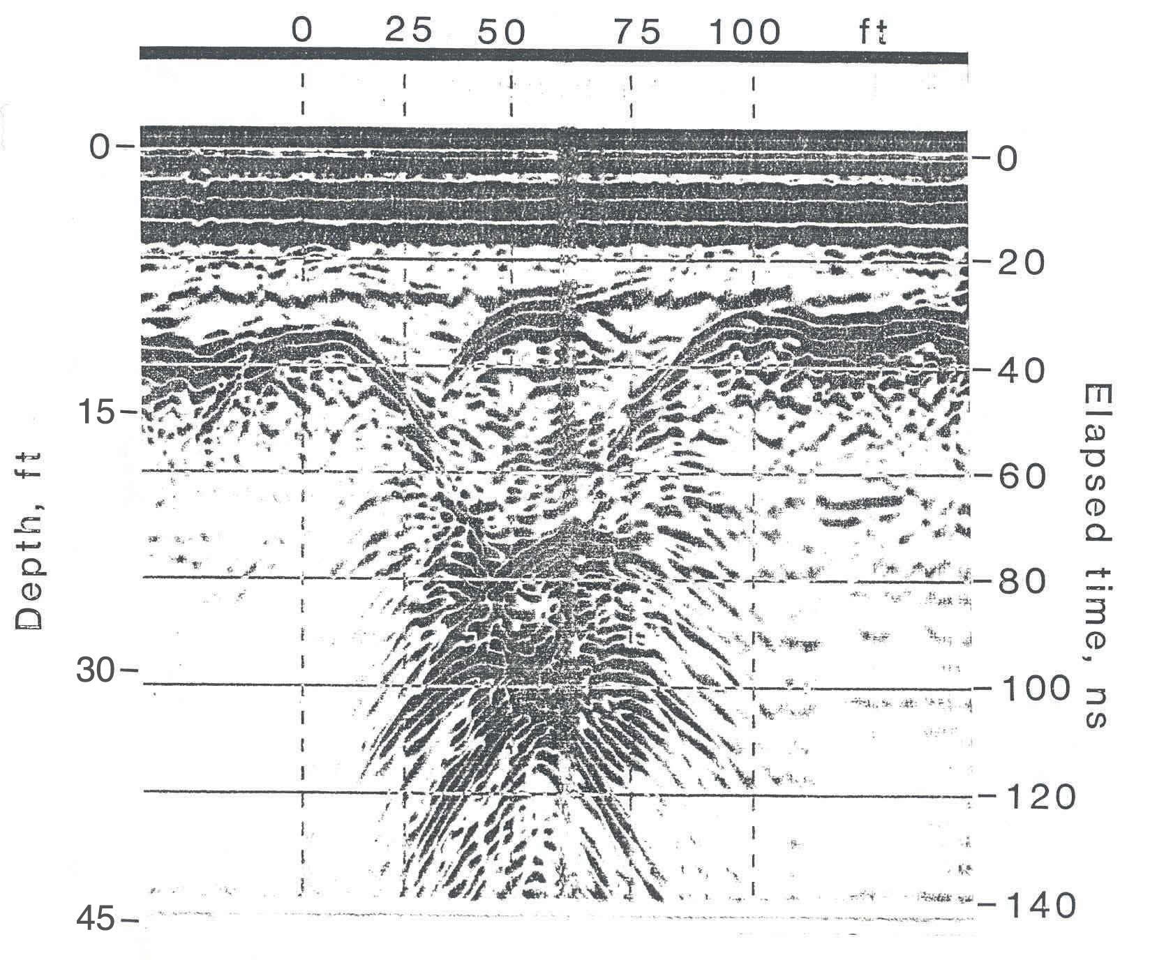
Sinkhole collapses have caused failures and losses of building and properties, damage to utilities and roadways, and ground water contamination. Such problems required millions of dollars payment to insurance and property owners every year in Florida. Damages could be avoided by the advanced detection of the areas subject to the development of sinkholes. Use of soil borings to locate the subsurface cavities would be economically unfeasible. Various geophysical techniques have been tested in an effort to detect the subsurface cavities. Thecommon geophysical methods, such as gravity, seismograph, electrical resistivity, magnetic, and electromagnetic radar, have been used to detect the subsurface cavities and features that related to the formation of sinkholes. In this paper, use of ground penetrating radar for sinkhole detection is presented.